Nepal Guiding Services
with
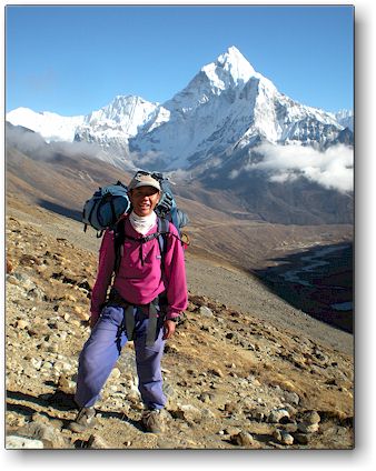
Machhendra Tamang
Typical Itinerary:
Annapurna Circuit Trek
(23 Days)
Annapurna Circuit Trek - To Manang
The Annapurna Circuit trek is known as the most diverse trek in the world. The complete circuit of the Annapurna massive an estimated 300km begins from lush sub-tropical forests below 800m in altitude. The scene changes everyday from rice paddies to pine forests to Tibet like country on the northern slopes of the Himalaya in the district of Manang. Manang was only opened to trekkers in 1977, although a few mountaineering and scientific expeditions had visited this region in 1950s.
The 'Circuit' Trek - After Manang After Manang, the terrain turns to high altitude ice desert over Thorung la pass at 5416m, down to Muktinath, Jomsom until the forested areas below Tukuche. The Kali Gandaki River on the other side of the Thorung La is considered the deepest ravine in the World, 5 times deeper than the Grand Canyon. The Kali Gandaki River cuts deeply between Mt. Dhaulagiri (8167m) to the west and Mt Annapurna (8091m) to the east. |
You continue down the Kali Gandaki gorge amidst some stunning views of mountains and diverse flora and fauna in the lower forests passing through Ghorepani with a magnificent sunrise view from nearby Poon Hill. Trekking will end here and you can relax near Lake city of Pokhara.
Day to Day Itinerary (23 days)
| Day 1: | Arrive Kathmandu and transfer to Hotel. (1330m) | |
| Day 2 : | Half day Walking tour of Ason the old market place | |
| Day 3 : | Drive to Besi Sahar. (750m) The drive to Besi Sahar takes about 5 hours. Leaving Kathmandu valley you are driven on the Tribhuwan Raj Marg (Highway) along the Trisuli river until Mugling. From Mugling you have to move Westwards along the Marshyangdi River. You will be trekking along the Marshyangdi river until the day you move over the Thorung la pass. (5416m) From Besi Sahar we have a short trek of 90 minutes to 2 hours towards the village of Khudi. After an hour's walk, you will cross a bamboo bridge, which signifies the approach to Khudi. You can relax to the sound of the mighty Marshyangdi. |
|
| Day 4 : | Trek to Bahundanda (1310m) 5 to 5.30 hours Leaving Khudi, you will pass by a local school on the right side. You will have to stop at Bhulbule where there is a check post for the Annapurna Conservation Area Project (ACAP). You will cross a steel bridge over the Marshyangdi river, which serves as a vital connection between both the sides of the village. You will pass through level rice fields until the village of Ngadi (The birthplace of Late DR. Harka Gurung). Your trek leader will probably suggest a short break for lunch. After lunch, you will cross another large suspension bridge over the Ngadi River where the trail begins to ascent straying away from the Marshyangdi river through woods. The last hour is a steep climb to Bahundanda (Hill of Brahmins) through cultivated land. |
|
| Day 5 : | Trek to Chyamje (1430m) 6 to 6.30 hours Leaving Bahundanda, you will descend on several stone steps. The farmers here harvest 2-3 crops a year in these lowlands depending on the rainfall. The path levels off and from here, the small villages of Sildhunga and Tadring are seen on the hillside opposite the valley. Contouring along the undulating' path until the descent to the small settlement of Syange. You will take a short break for relaxation before the descent at Ghermu phant for a drink while enjoying an impressive waterfall on the opposite side of the valley. You need to cross a suspension bridge across Marshyangdi. You will notice the sides narrowing and getting steeper while walking up the valley. You may pass mule trains along the way. From here is a steep climb to the village of Jagat. A series of up and down walk brings you to Chyamje, the final stop for the night. |
|
| Day 6 : | Trek to Bagarchhap (2160m) 6 to 7 hours You will cross a suspension bridge to the eastern side of the Marshyangdi soon after leaving Chyamje. You will pass along a series of over hanging rock formations. The path begins to traverse a broad ledge after a short climb. You will then come to a series of stone steps as you pass through a couple of teashops while going uphill. The trail evens out after a while and you will cross an archway, which is the gateway to Tal and the Manang district. Tal means lake in Nepali. You can see a broad expanse where a lake used to be. The Tibetan influence gets more evident from here on with Chortens', Gompas' and the beautiful architectural designs of the buildings. The trail from Tal levels out for a while, a welcome relief for your legs. You will cross a bridge back to the West of the Marshyangdi about an hour later. You can see the old trail on the other side which was recently abandoned due landslides. The trail continues upwards until the village of Dharapani where there is a police check post. Bagarchhap is just a 45 minutes walk from Jagat. |
|
| Day 7 : | Trek to Chame (2630m) 5 hours Great views of Mt. Annapurna II (7937m) and Mt. Lamjung Himal (6932m) will greet you as you proceed up the valley. You will reach the village of Danakyu after a walk of 30 minutes. If you look beyond the lofty peaks of Mt. Manaslu (8156m), the eighth highest peak in the world and Peak 29 (7833m) would be visible on clear days. There is a steep climb of about an hour through Pine and Fir forest with spectacular scenery. You may see Langur monkeys in the forest. Then, you will reach Timang village with spectacular views of Manaslu (8156m). Continuing on the flattish path along the river, the village of Thanchok is reached. The towering Annapurna II (7937m) is incredible further up the trail. The path rejoins the main trail while descending through woodland down to Koto, which sits in the shadow of Annapurna II (7937m). The Nar Khola river flowing from the recently opened valleys of Nar and Phu joins the Marshyangdi from the right side of the valley. Chame, which is the district headquarters of Manang, is a short walk from here. There are excellent views of Lamjung Himal (6932m) from here. |
|
| Day 8 : | Trek to Pisang (3190m) 5 hours A short day of trekking to Pisang. However, as it is so beautiful most of the trekkers take their own time to admire the scenery and click many photographs. You will pass through a series of mani walls. The trail is pretty even until we arrive at the apple orchards of Brathang. The trail heads uphill for about 45 minutes through forest, leveling off before reaching a suspension bridge. A moderate climb follows after crossing the bridge through a forest consisting of Juniper, Pine and Fir. The valley begins to broaden and Pisang Peak (6091m) stands out in front of you. You will pass through a couple of small lakes where sometimes birds can be seen wading. Pisang is divided into upper and lower. |
|
| Day 9 : | Trek to Manang (3500m) 5 hours (Lower Route) or 7 to 8 hours (Higher Route) There are 2 options for this day. You can follow a lower route of 5 hours stretch or a higher route of 7 to 8 hours stretch. If you take the lower route, it is less strenuous route, the path out of the valley is leveled and then once out of the valley you will begin to contour round to your left and climb up onto a ridge. The view from this ridge is breathtaking looking down into the Manang valley and you will like to stay here all day to enjoy it. Dropping to the valley floor the path is wide and dusty. You will notice that the scenery here is more arid, the air drier and the wind colder. Annapurna III (7,555m) rises to the left and passing through the village of Hongde you will see the deserted remains of the old village on its outskirts. The path then rises gradually and takes you to the next valley. After a couple of hours walk you will pass through the village of Braga, just 30 minutes walk from Manang. The High route If you are feeling fit and energetic then the high route on the eastern bank of the Marshyangdi is strenuous but well worth the effort. You have to cross the river out of Pisang village and then take a reasonably level path through scrubland, passing through a small picturesque lake on your right. You will then pass a long mani walls' and descend to cross a stream and begin a strenuous zigzagging climb up to the village of Ghyaru (3,673m). A welcome teashop is the first house you will come across in the village. It is well worth climbing up to visit the Gompa at the top of the village. The views from here of Annapurna II and Annapurna IV are very stunning. From Ghyaru you will continue up the valley on a wonderful high-level trail. Here, passing through the ruins of a castle, we will set on a promontory, with views both ways up and down the valley. Then, we will arrive at the village of Ngawal (3,650m) where there is a large newly built Gompa up to the right. You will leave the village near a long mani wall. Finally, you will descend back to the valley floor and rejoin the main trail to continue to Braga and Manang. |
|
| Day 10 : | Trek to Rest Day for Acclimatisation It is essential to spend time for acclimatisation in this area. There are splendid views of the peaks from both Manang and Braga villages. Manang is a large village situated on a rise immediately across the huge Gangapurna glacier. A beautiful emerald lake lies at its foot. There are plenty of good walks in the area and for at least a couple of hours you can try to climb as high as possible above the village. Side trips are recommended to a small summit with prayer flags about an hour above Braga village, or up the ridge behind Manang village, or to a viewpoint above the lake opposite Manang Village. It is also possible to walk up the valley towards Tilicho Lake to the village of Khangsar. In addition, it is worth visiting the Manang Gompa or if it is open, visit the clinic run by the Himalayan Rescue Association. They often have talks about altitude in the afternoon. There are also shops to explore for souvenirs. |
|
| Day 11 : | Trek to Yak Kharka (4090m) 4 hours Despite being a shorter day, it is essential for acclimatisation to stop between Manang and Thorung Phedi. You will leave Manang and take about 30 minutes to reach the upper village. Afterwards, you will contour round the hillside and gain great views of the G rand barrier, the high ridge between Roc Noir and Nilgiri named by French climber Maurice Herzog. Below the grand barrier you will see down the Khangsar valley which leads up to Tilicho lake. Passing the hamlet of Gunsang you will continue through the upper barren reaches of the Manang valley. The path ascends gradually but it is still hard work due to the increased altitude. You will arrive at Yak Kharka and will have lunch there. In the afternoon, you could take a walk further up the valley or climb the ridge behind the village. If you make it to the top of the ridge, there are great views of the northern side of the Annapurna range. Either of these walks would help with acclimatisation. Even if you only venture a short way above the camp there is the chance to see the large flocks of blue sheep, which inhabit this area. Either of these walks would help with acclimatisation. |
|
| Day 12 : | Trek to Thorung Phedi (4420m) 4 hours Again a short day yet essential for proper acclimatisation. Leaving Yak Kharka you will pass through the small collection of lodges known as Letdar. You will take a high route, which winds its way around the eastern side of the Thorung valley, before dropping down to the valley floor. Crossing the river there is a short but sharp climb to Thorung Phedi. Phedi means foot of the hill and while it is the jumping point for crossing the Thorung La, it is the prettiest place in the world. In the afternoon, it is worth walking up beyond the first notch to the collection of huts known as upper base camp as an acclimatisation walk, and then continuing up to the right to a small peak for all round superb views. Watch out for blue sheep here. |
|
| Day 13 : | Trek to Muktinath (3800m) via Thorung la (5415m) Approximately 8 to 10 hours Starting at dawn, you will first ascend steeply for 1½ hours to a rock ledge and notch at 4,679m, and then continue up along an ascending and undulating trail. This ascent will seem endless and be careful, as there are several false summits. However, there are great views back down the valley as you go. Finally, after 3 to 5 hours of walk, you will arrive at the top of the Thorung La (5,416m) with its large cairn and many prayer flags. You will have spectacular views of the Annapurna Range to the south and the Mukut Himal bordering Dolpo to the west. The peak immediately to the south of the pass is Thorung Peak this is a trekker's peak' and you may see people climbing here. You will probably not want to linger too long at the pass as it can be very cold and you will probably be feeling the effects of altitude. The descent to Muktinath is very steep and it takes about 3 to 4 hours. This is where you might appreciate having walking poles to take the strain off the knees. During the descent, there are splendid views of Dhaulagiri (8167m) and Tukuche Peak (6,920m) and all the way down into the valley of the Kali Gandaki below. Finally, you will see the buildings of Muktinath coming into the view. You will bypass the enclosure round the famous temples and descend to the main village, which is actually called Ranipauwa and not Muktinath, a name that technically refers just to the temple. |
|
| Day 14 : | Trek to Marpha (2665m) 7 to 8 hours You will start your trek today by walking down from Muktinath. You have to walk for about half an hour towards the northern side of the police station to reach the pleasant village of Chhyonkhar. Here, a wooden bridge over the river has to be crossed. A proper road is not developed to reach this area but the Village Development Committee has a budget for building it. You have to take the downhill path and cross the suspension bridge to reach Jhong a beautiful village. Here, a very old monastery exists dating back to the 7th or 8th century and the ruins of an old fort. The village has 40 households and a restaurant named Milan where tea and coffee is served during the tourist season. After walking downhill for another half an hour to 45 minutes, you will reach the road crossing at Putak. There are two roads leading out - the lower road goes alongside the river and leads to Khinga while the upper road goes towards Kagbeni. You need to begin by walking over a dry section of the riverbed to reach the small settlement of Eklaibhatti, which means a lone tea house' but the original lodge here is now joined to other buildings. As you walk down the valley, look out for ammonite fossils among the pebbles. These are sacred to Hindus who call them shaligrams'. You have to cross the suspension bridge and walk along a trail on the bank of the Kali Gandaki river until you reach Jomsom to avoid the motor road. Jomsom - the administrative headquarters of the Mustang District is rather a dusty, characterless town with STOL airstrip, police station, army camp, banks and shops. It is possible to telephone from here. The Kali Gandaki is called Thak Khola here and the local people belong to the ethnic group known as Thakali', an enterprising and ambitious community who formerly dominated the salt trade with Tibet as it passed down this valley. After the collapse of this trade in the 1950s, they diversified into other businesses, most notably running hotels along the trek routes. Their former wealth is reflected in their fine villages, the principle ones that you visit being Marpha and Tukuche. After lunch at Jomsom, you will continue walking below the Airport and cross the bridge onto the Thini Village and the Dhumba Lake area passing by pine and juniper forests. There is a monastery here and the local people follow either Buddhism or the ancient Bon religion. You walk down towards the river, and cross the wooden bridge to reach Samley village. After walking for about 45 minutes, you will arrive at Dhumba Lake. This lake is considered sacred by most folks, especially the Thakali people. There is a monastery near the lake named Dhumba Gompa. From the monastery, you will experience good views of Thini, Jomsom, Syang, and Marpha villages, along with Dhaulagiri, Tukuche Peak, Dhampus Peak, Thapa Peak, and Tashikang Peak (Nanda Bhauju Takura). A village named Dhumba Gaon lies to the southern side of the hill. An hour's walk from the monastery takes you to Chairo Gaon where you can see the Tibetan Refugee Camp, monastery, school, small tea shops and many large pine trees. Then, you will cross the Kali Gandaki river and spend a night at Marpha. Marpha is a lovely village with paved streets and well- maintained, whitewashed houses surrounded by productive fields and orchards. In the autumn, be sure to try some of the beautiful, locally grown apples or better try to taste the local apple brandy. The well maintained Gompa is also worth a visit. |
|
| Day 15 : | Trek to Larjung (2550m) 6 to 7 hours You will cross the Kali Gandaki and walk through the Chairo Gaon. A two-hour walk takes you to an exceptionally beautiful village - Chimang Village (2,850m). You have to walk 20 minutes downhill to the Chiming river. Cross the river and walk for another 20 minutes towards Dading to reach Chokhopani village. Before Chokhopani, a suspension bridge has to be crossed to reach Tukuche Gaon. Further, up from Tukuche, the Kaligandaki river hits the banks as it flows down. In the 19th century, Tukche played a central role in the salt trade with Tibet. The doors and windows of the houses in this village are very artistically created. Another attraction of Tukuche is the Tukuche Distillery, which produces the famous Apple Brandy and Apricot Brandy. After leaving Tukuche Gaon from its lower end, you will cross the wooden bridge and then walk for one hour to reach Sauru Village. This is another remarkable village but recently there was a flood in this area leading to the destruction of many houses and farming land. Since, this village does not provide proper accommodation, stay overnight at Larjung, which is just 40 minutes from Sauru. |
|
| Day 16 : | Trek to Ghasa (1860m) 7 to 8 hours You have to cross the wooden bridge at the lower end of Larjung to reach Nupsang Kharka (2,980m) via the small village of Sirkung. This route offers a chance of seeing different species of birds and various types of trees such as pine and rhododendron. There are great views from Nupsang Kharka of Dhaulagiri, Tukuche Peak and Dhampus peak. A road heads straight down to Thiti Gaon and Thiti Taal (Lake). You have to walk along the road for an hour towards the left of Nupsang Kharka, passing through Taglung to reach Kunjo Gaon. Kunjo Gaon (2,580m) has telephone services, a small tea shop and a lodge. You have to cross the Lete river and have to walk along the dusty road until you reach Ghasa. You can also avoid walking on this road but it will be an unnecessary diversion of 40 minutes. |
|
| Day 17 : | Trek to Tatopani (1190m) 7 to 8 hours After breakfast, you will leave Thakali country for Ghasa, an area populated by Brahmins and Chettri hill farmers and members of hill tribes such as Gurungs and Magars. The trail climbs high above the river through a narrow gorge. You have to leave the former trail route at Kopchepani and climb uphill to reach Bhalebas. Rupse Chhahara is seen on the opposite side of Bhalebas. You have to stop for lunch at Kopchepani. After lunch, you will walk by a Brahmin-Chettri settlement and the hydro power plant. Then, you will cross the bridge at Topang to reach the main trail, which leads to Tatopani, a bustling village that has long catered to the needs of trekkers. In Tatopani, which means hot water' in Nepali, there are natural hot springs down by the riverside, which are great for a relaxing soak. |
|
| Day 18 : | Trek to Chitre (2390m) 5 hours Continuing down beside the river, you will cross a long suspension bridge to the eastern bank. At a cluster of houses, the trail divides: one branch continues downstream to emerge at the road ahead to Beni but your path takes off steeply uphill, making an altitude gain of about 4,000m to reach the small settlement of Chitre. |
|
| Day 19 : | Trek to Ghorepani (2800m) 2 to 3 hours Today it is a short day's walk. You will continue walking uphill to Ghorepani (horse-watering place). This was a main staging post on the old trade route to Pokhara although nowadays it is less utilised with most of the mule traffic going down the Kali Gandaki to exit at the road head at Beni. The main settlement of Ghorepani is down the other side of the pass but most trekkers stay in the settlement at the pass itself to be in a good situation for climbing Poon Hill. You should be able to arrive here by lunchtime. If weather condition is clear in the afternoon, you can climb Poon Hill (10,495ft/3,190m), which offers a magnificent panoramic view of the mountains, during afternoon. To the east, across the Kali Gandaki, towering is Daulgiri, while Annapurna to the South and Hiunchuli directly in front of you, with Machapuchare and others looking less distinguished a little further to the East. Far to the east the rolling hills diminish in size, you can see the serpentine Chinese road snaking its way through the hills, and where the road ends at the Phewa Tal (Lake), Pokhara can be seen. If it is cloudy, it is better to leave the climb of Poon Hill until sunrise the next morning. |
|
| Day 20 : | Finish trek at Nayapul and drive on to Pokhara (915m) 5-6 hours At sunrise, you can climb Poon Hill, if you have not climb last evening, to see the mountains turn pink - one of Nepal's classic views. Return to the lodge for breakfast and then descend from Ghorepani to fine oak/rhododendron forest. As you descend, you will pass through the small settlements of Nangethanti and Banthanti and then emerge from the forest into cultivated land above the large and picturesque Magar village of Ulleri (6,800ft/2,073m). From here, it is a long descent on stone steps to reach the river, where you will cross a suspension bridge to the village of Tirkedhunga (1,577m) - a total descent from Ghorepani (1,200m). The trail then descends in a more sedate fashion down the valley of the Burungdi Khola to the village of Hille. Continue descending down the valley of the Burungdi Khola, passing a waterfall on your right with a beautiful pools at its base (for good swimming) to arrive at the bizarre bazaar town of Birethanti with its sturdy houses, paved streets and café terraces overlooking the Modi Khola River. Then, you will cross the river on a long suspension bridge and then it is a further 20-30 minutes walk alongside the river to reach the road at Nayapul where your transport will be waiting to take you to Pokhara. Stay overnight at Hotel. |
|
| Day 21 : | Late afternoon flight to Kathmandu | |
| Day 22 : | Free Day in Kathmandu. | |
| Day 23 : | International Departure | |
See other Treks: Everest Region, Langtang Region, other Annapurna treks |