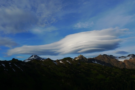
 Image from "Garfunkel", 2011 |
Pacific Crest Trail Resources Page |
 |
Greetings from JacknBarb (TJ and Boo Boo) This resource page accompanies the 18 minute YouTube Video - Hiking the Pacific Crest Trail, Basic Information (watch it!) |
||
Watch the 2011 Class Movie - The big snow year. (compiled by JnB) rt.1hour 16 min. (images from 80 hikers) See a fun entertaining movie we produced before hiking the trail rt. 4 min. I unload my pack after the hike - 20 min. movie Read our journal - planning and hiking, day by day email us: jackandbarbpct@gmail.com Fun! A short 4 min video showing the terrain/people from Mexico to Canada. How much will a PCT thru hike cost? On the low end, $3000 plus transport, on the high end, $8000 plus transport (we came in at about $5500 each). Typical costs below.
Permits and Planning It is expected that about 1,000 people will attempt a thru hike of the PCT this coming year (2015). Of those that start, about 60% will make it to Canada. Hikers of all ages will be on the trail but the greatest segment will be those aged 20-29. More complete stats coming soon. PCTA.org You hike the trail, help them maintain it. Become a member! Hiking permit information, provide by the PCTA - includes info for climbing Mt. Whitney Canadian entry permit - Fill out this form online, print it and mail to Canada about 6 weeks before your hike. Note: If you choose, you can turn around at the Canadian border and hike back 30 miles to Hart's Pass where you might get lucky and get a ride to Mazama, WA (forest road), or continue hiking on to Rainy pass (another 33 miles) reaching highway 20 where hitching should be easier. Hiking FAQs from the PCTA Camp stove and campfire restrictions - there have been some bad fires in California recently. As a result, you may be restricted in the type of stove you will carry. California campfire permit - watch a short video, take an easy quiz, print out your permit. Craig's PCT Planner - Plan your entire hike! Spend some time with this and modify various sections (like in the Sierra, you will not be racking up a lot of miles each day, and in Oregon, you will fly!). Create an account (free). A starting point: 2.2 to 2.5 mph, 10 hour days and 30 min for every 1,000 ft ele. gain. Mileages from Mexico to Canada on the PCT (from 1990 book, somewhat accurate) BearCant's interactive PCT altitude map - fun and interesting. Visit CA section "H" to see what the Sierra has in store for you! Maps: Halfmile's paper map set, 455 pages - Be sure to notice and carry the altitude profile pages at the end of each section. You will NOT want to carry the entire set with you at one time! Put the set in your bounce box or have sections mailed ahead. You can print or download your own Halfmile map set here. (but you may spend more for ink than purchasing from Yogisbooks). See the additional links on right of Halfmile's web page. Yogi also has a two part book with some valuable trail town guides and maps. Water: Plan each day around water sources. The Southern California Water Report - is an indispensable resource. During the hiking season, it is regularly updated by hikers on the trail. It can be uploaded to your smart phone whenever you have service. (see the HYOHPCT app below) Note: Never rely on water put out by trail angels (water cache), even with an updated water report. A cache that has 50 gallons could disappear in a day or two as large numbers of hikers pass through. Always plan for a dry water cache and carry extra. If you find any water source to be inacurate, please send in an update to the water report at your first opportunity. The driest stretch of trail is Section F, miles 609- 651. You will have to leave the trail on occasion to get water - Do it if you need water, even if it means hiking a few extra miles. Phone Apps Halfmile's GPS tracks and waypoints. We just love this guy! GPS Garmin tracks and waypoints covering the entire trail, even without an electronic map, you will have a track to follow - but you might prefer to leave the gps at home and use the Halfmile phone app instead Halfmile's trail notes - also worth having in pdf on your phone or printed out PCT-l online forum, read the archives, ask questions A very informative site with lots of useful links (PlanYourHike.com) A very comprehensive FAQ page (Postholer.com) Equipment Gear Weights - Skin out weight vs base weight A thru hikers gear list with a base weight of 9.5 lbs Our gear list - lightweight but not ultra-light See many more gear lists here Some tent suppliers: ULA, Gossamer Gear, Z packs, Osprey, Golite, MLD (Mountain Laurel Designs), six moon design Bear Vault BV500 - see a bear try to break in! Watch ice axe self arrest video better yet, take a winter mountaineering course and practice self arrest when you get into a snowy area. Another good video here Proper use of hiking poles It's not rocket science but do learn how to run your hands properly through the straps and use the straps to your advantage. Cell phone coverage - We were surprised to find reception in some of the most out of the way places but mostly, you will have no signal. It appears that Verizon has the best coverage on the PCT. Food What hikers eat is across the board. Some go to great lengths to prepare meals, others boil up a package of Ramen noodles and dump in a can of tuna fish. Big trail items seem to be Knorrs packages, Idahoan mashed potatoes and the like. Dehydrated food is best as it carries the most calories with the lightest weight. Some hikers dehydrate meals at home and pack them in their resupply boxes. Others carry olive oil and dump some into every dinner. Oils have more calories per weight than anything else. Some hikers have hot oatmeal and coffee every morning, some cook lunch. Some eat dinner early and hike on to their campsite. Only you can decide but you should be counting calories. Breakfast for us was either granola with powdered milk (350 cal) or a 230 cal Oatmeal-on-the-Run bar (no longer available). We would start snacking an hour or two later. Lunch would be pb&j on tortillas, bread or bagels, sometimes salami and cheese, sometimes with chips like pringles or fritos. After lunch, we would eat more snack items (gorp, candy bars, lara bars, kind bars etc) throughout the rest of the day. We only heated water once per day (dinner) and lived almost exclusively on Mountain House meals (460-520 cal). We found a great deal at CostCo, qty 10 two person meals for $40. There was a variety of four different meals too. Barb and I consumed a 2 person meal each evening. From Oregon to WA, I would regularly have a desert of Jello Chocolate Pudding - serves 4, I would eat the entire package (add powdered milk and water, 240 calories). Sometimes I would crush up some fritos and dump them in the dinner pouch - YUM! My go to snacks were snickers (dark chocolate), M&Ms, PayDay bars, Lara Bars, pre-packaged GORP and beef jerky. I also had a home packaged maltodextrine sports drink (sugar and electrolytes) at 300 cal per liter that I would sip on throughout the day (2 packs per day). I would sometimes burn through 5 or 6 snack items per day. Good info on Food This website, planyourhike.com has lots of other valuable information as well. Food and lodging at the towns along the PCT. Reviews of trail towns (somewhat dated info) Trail Magic - NEVER plan on trail magic for your next meal and if you plan to assist hikers, please try to avoid hosting unattended caches. Never leave your trash at an unattended trail stop. Better yet, take any trash you find at one with you. If you plan to cache water for hikers, visit your site periodically and police the area, removing all of your empty containers. Have a plan to keep your empties from blowing away in the wind. Note: A welcome stop at Donna and Jeff Saufley's Hiker Heaven (Agua Dulce, mile 454). They are friends of ours, tell them we said 'Hi from Jack and Barb". As for all trail angel stops, check in advance to see if they will be open when you pass through. Fuel availability on the trail (an entry on the PCT-l) You might also consider multi-vitamins and in particular where it is hot, electrolyte replacements (sodium, potassium and magnesium especially). You should be getting plenty of Vitamin D from the sun. Photography - we have lots of info here Training for a thru hike: By February or March, start walking. Walk some more, climb hills, stairs, or steep streets. Walk some more with a light pack on. Eventually try to complete 15 miles once a week, for about 3 weeks before your PCT hike. On the off days do 3-5 miles. You should be able to do 15-20 miles at the start. The first leg, Campo to Lake Morena is 20 miles. If you are in shape, get a ride to Campo with a day pack and do the entire 20 miles ("slackpack") in the first day. Don't forget to sign the register at the Southern Monument, and carry sufficient water. Hygiene - Practice good hygiene and you will increase your odds of staying well. Be careful when dipping your hand into a big bowl of chips or popcorn that many other people are dipping into. Need we say more? Injuries - Shin splints, tendinitis, and stress fractures are due to overuse and pushing yourself too hard. Take it easy especially at the start of your hike. If you develop a problem, take a few days off to rest and assess the extent of your injury. It is better to leave the trail and come back the following year than ruin your body forever. Also watch out for infections. A small wound can easily get infected on the trail. If you see lots of redness and swelling, seek medical attention asap. Keep an electronic journal Postholer is a good, free online journal portal. You could go old school and can carry a notebook and even colored pencils or write electronic journal entries to your phone and upload them when you get to a town. We carried a very small voice recorder and each evening, recorded miles hiked, trail conditions and things that happened during the day. It helped us remember what happened each day. When we were in towns, we would transcribe and upload to postholer. You could use the recorder app on your phone for this. If you want to send up more than 5 images to a Postholer journal, contact Scott at and he will set you up to a max of 15 per page. Facebook has become a popular site to stay in touch with fellow hikers in your year. Search for Pacific Crest Trail 2018 (enter your year). A class movie may be produced by someone in your class. They will need your pictures and movies to make a super video (usually about 1 hour long). Look or ask for info on facebook. Find the videos on youtube or vimeo. First Aid We carried about 1/4 lb of first aid. It was mostly an insurance policy. You should have blister pads and/or moleskin and an antibiotic cream like neosporin or bactracin. We also carried Cipro, a strong antibiotic, Flagyl, for giardia and some very strong painkillers (hydrocodone), all by prescription from our doctor. Don't forget your "Vitamin I" - Ibuporphin - the most popular pill on the trail! Hitchhiking tips Remember, you do not have to take a ride if it doesn't feel right. Just say "You know, I'm gonna pass but thanks anyway for stopping" A complex undertaking (essay) Trail Names - A name might happen to you. Most people knew us as JackandBarb or JnB. Barb got her name Boo Boo from a screw up when we were slacking section a. Jack got his from carrying tequila all the way to Canada. Names with one to three syllables are best (Tequila Jack = "TJ") Stuff at home - Plan ahead. How will you mail be collected or forwarded? Are you leaving your home empty? Who will take care of your pets or houseplants? Any bills that you will need to pay? SPOT Satellite GPS locator beacon Allow your friends and family to plot your progress and see where you are each day. If you have an online journal with postholer, you can set it up to automatically pinpoint your whereabouts on a map. If things go really south, press the "help" button and search and rescue will find you. Device weighs 4.6 oz with (3) AAA batteries. NOTE: There is a gen 3 out now that is even better than the gen 2 that we used. You can find used Gen2 units on ebay. Let your signal beam up for at least 15 minutes to insure reception by a satellite. Information page on SPOT here. Regardless of whether you use one of these or not, it is a very good idea to stay connected with at least one person off the trail. Reassure family and friends while you are gone - Do check in regularly and let your friends and family know that you are ok. Tell them when you plan to check in again. Travel with other hikers, especially in the Sierra, especially if it is a big snow year or you are in extremely hot conditions. Keep tabs on your crew. A hiker card - These cards are fun to have and are not very expensive. We chose a picture we shot while on a training hike in April and went online to Vista Print and in 30 minutes or so, had our order complete. We ordered 500 cards ($ 30) and used almost all of them. We had them at the kickoff and put 10 cards in every resupply box. Our hiker stats - miles per day etc Purchase or borrow and inexpensive scale for weighing your gear. Our postal scale would weigh up to 10 lbs. Leave No Trace - The Seven Principles Somewhere along the trail, after the 700 mile mark, plan to spend a zero or nero (no miles) day on the trail. Danger, it might become addictive! (we spent only one nero day at mile 774). What day should you start? Assuming you are going NoBo and not a super speedy hiker, the best time to start is sometime from early April to early May. Your decision should be based on the current snowpack in the Sierra. On a normal snow year, you will want to reach Kennedy Meadows (mile 702) around June 10-20th. You can find current snow statistics on postholer but you must register (free) to view this page. Try to keep your start date as flexible as possible. To see what dates the current hikers are shooting for, go here (it would be best to avoid starting on the peaks). The graph shows March, April, and May. And, check this out, the location of the "average" hiker (this would be the herd) - data culled from 302 journals. This is extremely useful data for planning. Do you have any exceptional resources that we can add here? Email the link to us. Link #1 Backpack45 |
||
Contact Us: JackandBarbPCT@gmail.com |
||